

Two Centuries in the Making
The Interstate Highway System didn't begin in 1956. It was the endpoint of 145 years of federal road-building experiments, military lessons, and one president's conviction that the country needed a connected national network.
Long before the first shovel of interstate-grade concrete was poured, the federal government had already tried, and mostly struggled, to build a national road network. This page traces that entire arc: the country's first federally funded road, the private highway associations of the early auto age, a young Army officer's brutal cross-country convoy, and the legislative act that finally tied a funding mechanism to a 40,000-mile vision.
What follows is every major milestone, in order, each sourced to the Federal Highway Administration, the Library of Congress, the Eisenhower Presidential Library, or peer-reviewed transportation history.
Every Milestone, Start to Today
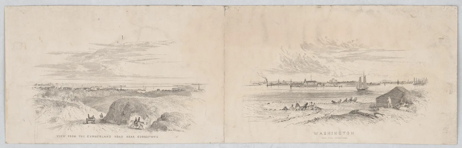
Congress authorized the Cumberland Road, later known as the National Road, in 1806 under President Thomas Jefferson, and construction began at Cumberland, Maryland, in 1811. It was the first road ever built entirely with federal money, a novel and constitutionally debated use of federal power at the time, since the Constitution does not explicitly authorize Congress to build roads.
By 1818 the road reached the Ohio River at Wheeling, and it was eventually extended through Ohio and Indiana into Vandalia, Illinois, before funding ran out in the 1830s. Congress appropriated roughly $6.8 million between 1806 and 1838 for the project, an enormous sum for the era, and the road became the primary corridor for westward migration into the Ohio Valley for the next generation.
The constitutional dispute was not academic. President Monroe vetoed an 1822 bill to collect tolls and pay for repairs, believing Congress had no power to do so, and upkeep was gradually handed off to the individual states the road passed through.
Much of the route was paved and folded into U.S. Route 40 in the 1920s, and long stretches of Interstate 70 and Interstate 68 follow the same corridor today, so the National Road's alignment still carries cross-country traffic two centuries later.
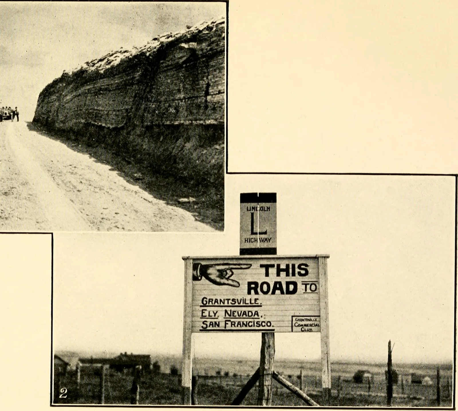
By the early 1910s, automobile ownership was exploding, but there was still no coordinated system of roads connecting the country; a cross-country trip meant stitching together a patchwork of local dirt trails, some barely passable in wet weather. Indianapolis Motor Speedway founder Carl Fisher conceived a single continuous highway from New York City to San Francisco, and the Lincoln Highway Association, backed by industrialists including Packard's Henry Joy and Goodyear's Frank Seiberling, formally dedicated the route on October 31, 1913.
It ran through 13 states and cut the time for a coast-to-coast crossing from roughly 60 days to about 20, but it remained privately promoted and locally maintained; the federal government still had no ongoing highway construction program of its own.
The association marked the route with red, white, and blue bands on utility poles and, in 1928, had the Boy Scouts place thousands of concrete posts bearing a bronze Lincoln medallion, some of which still stand along the old alignment.
Its lasting effect was political. By dramatizing how bad American roads were, it helped build the public pressure that produced the Federal-Aid Road Act of 1916, the first ongoing federal highway program. The route itself was largely superseded by U.S. Route 30 and later by Interstate 80.
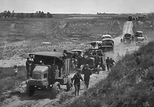
In the summer of 1919, the U.S. Army sent 81 vehicles and nearly 300 soldiers on the First Transcontinental Motor Convoy, following the Lincoln Highway from Washington, D.C., to San Francisco to test how quickly military traffic could cross the country.
The 3,251-mile trip took 62 days, an average of about six miles per hour, and the convoy suffered constant breakdowns, stuck vehicles, and collapsed bridges on the unpaved western stretches. One of the convoy's official observers, a 28-year-old lieutenant colonel named Dwight D. Eisenhower, later wrote that the trip convinced him the country needed good, permanent roads, an experience he would cite decades later while building the case for the Interstate System as president.
The expedition averaged only about 58 miles a day and damaged or destroyed some 88 bridges along the way; nine vehicles were written off entirely, and 21 men were hurt badly enough to leave the convoy.
Eisenhower had volunteered for the assignment partly for the adventure. The chapter on it in his 1967 memoir, titled "Through Darkest America With Truck and Tank," links the ordeal directly to his push for the Interstate System.
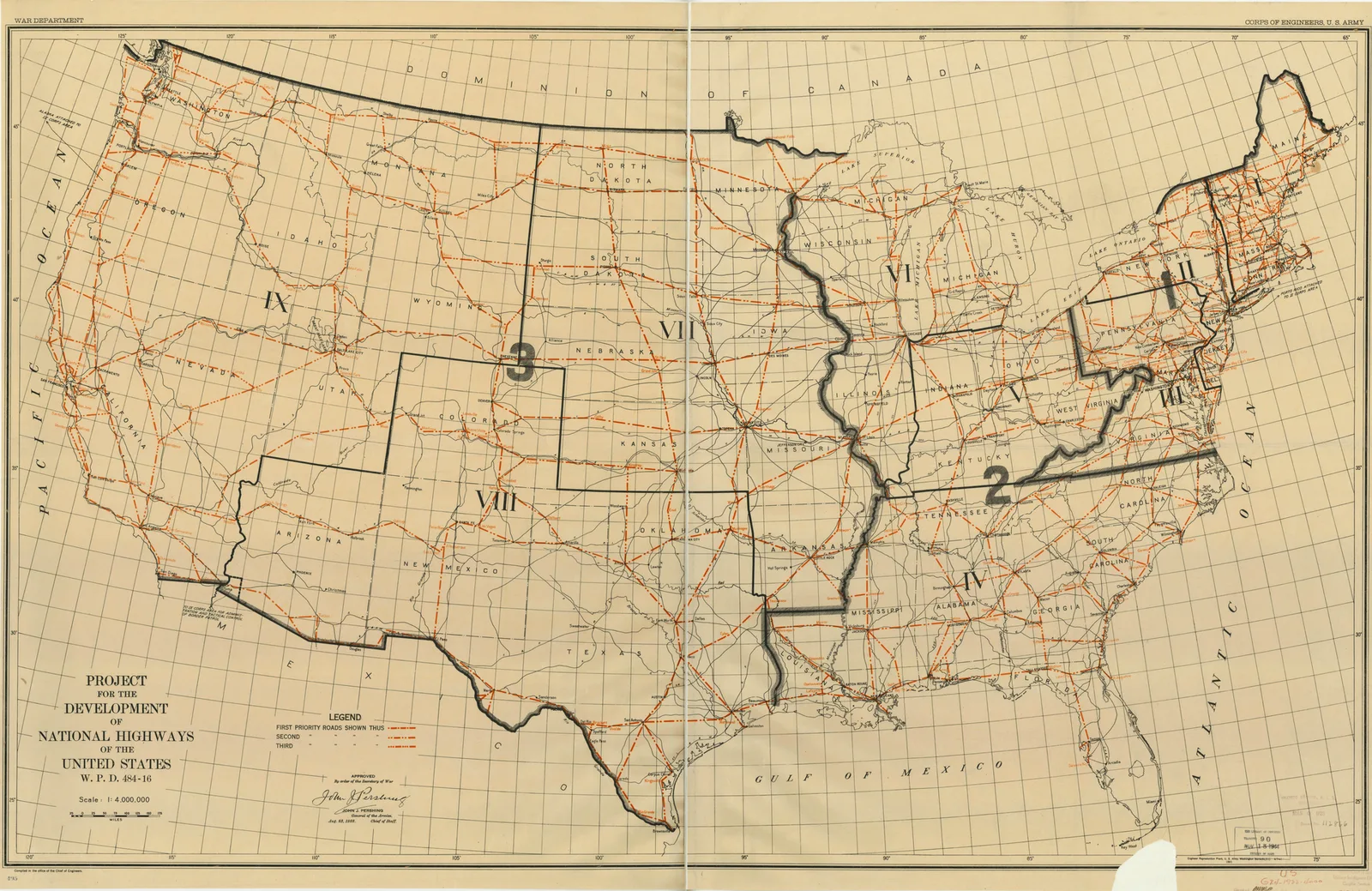
In 1921, Thomas MacDonald, the newly appointed head of the federal Bureau of Public Roads, asked the Army to identify which roads mattered most for national defense. General John J. Pershing's staff responded in 1922 with a map of roughly 78,000 miles of interconnected routes, concentrated around coastal areas, border crossings, and military installations, that the Army considered essential in the event of war.
The Pershing Map was the first attempt to plan American roads as a connected national system rather than a patchwork of local and state projects, and most of the routes it identified were later folded into the federal-aid highway system, laying conceptual groundwork that would echo in the Interstate System three decades later.
Those 78,000 miles amounted to less than 3 percent of the nation's roads, and Congress leaned on the map in 1923 and 1925 when choosing the routes for the numbered U.S. Highway system it created in 1926.
MacDonald, who commissioned the map, ran the Bureau of Public Roads for 34 years across seven presidents and did more than any other official to build the federal-state highway partnership the Interstate System would later use.
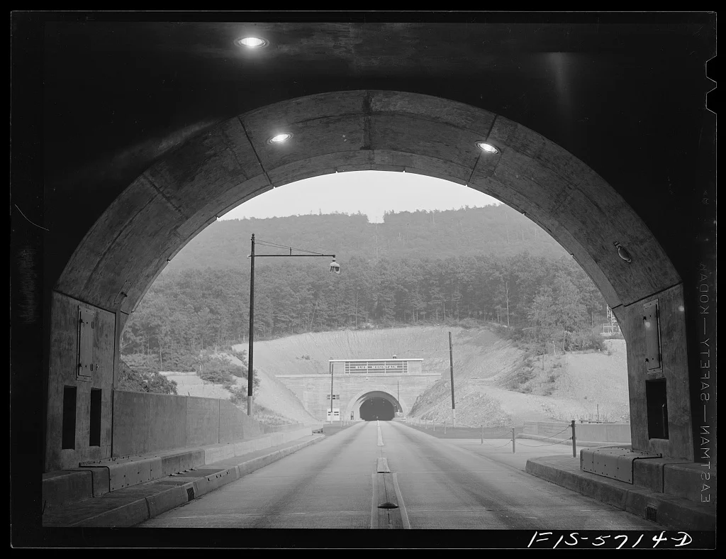
Built through 160 miles of Appalachian ridges and valleys with seven tunnels, and financed by a $41 million loan from the federal Reconstruction Finance Corporation plus a $29 million Public Works Administration grant, the Pennsylvania Turnpike opened on October 1, 1940, as the nation's first limited-access superhighway. It had no cross traffic, no stoplights, no driveways, and, at the time, no posted speed limit; cars simply entered and exited at widely spaced interchanges.
It was an immediate sensation, nearly 27,000 cars used it on its opening weekend alone, and for the next 16 years it served as the working model federal highway planners pointed to as proof that a nationwide network of high-speed, controlled-access roads was possible.
Engineers saved years by reusing the graded roadbed and six unfinished tunnels of the South Pennsylvania Railroad, an abandoned 1880s project backed by William Vanderbilt and Andrew Carnegie. That head start let the turnpike be built in about 20 months.
Traffic so far outran projections that New Jersey, Ohio, Indiana, and other states copied its bond-financed, toll-funded model in the late 1940s and 1950s, and many of those toll roads were absorbed into the Interstate System in 1956.
The Federal-Aid Highway Act of 1944 formally designated a 40,000-mile 'National System of Interstate Highways,' the first time the interstate network existed as an official federal designation.
But the 1944 Act provided no dedicated funding mechanism and no requirement that the routes be built to any particular standard, so for the next twelve years the designated system existed mostly as lines on a map. A handful of states built short interstate-quality segments on their own, but without federal money attached specifically to the system, progress stalled almost entirely through the rest of the 1940s and into the mid-1950s.
The 1944 law was also the first to authorize federal aid for roads inside cities rather than only rural routes, though the amounts were small and not tied to the interstate designation.
The 40,000-mile network had been recommended to Congress in two Bureau of Public Roads reports, "Toll Roads and Free Roads" in 1939 and "Interregional Highways" in 1944; the second report also, controversially, urged routing the new expressways straight through city centers.
Dwight Eisenhower's support for a national highway system was shaped by three separate experiences. First was the grinding 1919 convoy, which showed him firsthand how bad American roads were. Second was his experience commanding Allied forces racing across Germany in 1945, where he was struck by the German autobahn network, writing later that 'the old convoy had started me thinking about good, two-lane highways, but Germany had made me see the wisdom of broader ribbons across the land.'
Third was Cold War anxiety after the Soviet Union tested a hydrogen bomb in 1953, which raised fears that American cities could not be evacuated quickly enough in a nuclear attack. By the time Eisenhower took office, all three threads, military logistics, economic efficiency, and civil defense, pointed toward the same conclusion: the country needed a connected, high-speed highway system, and a reliable way to pay for one.
As president, Eisenhower first pushed a plan in July 1954, having Vice President Richard Nixon unveil it to the nation's governors and appointing a committee under General Lucius Clay to design the financing.
The Clay Committee's 1955 plan relied on federal bonds, and Congress rejected it over the debt it would add. The pay-as-you-go, gas-tax approach that finally passed in 1956 came out of the House, led by Representatives George Fallon and Hale Boggs.
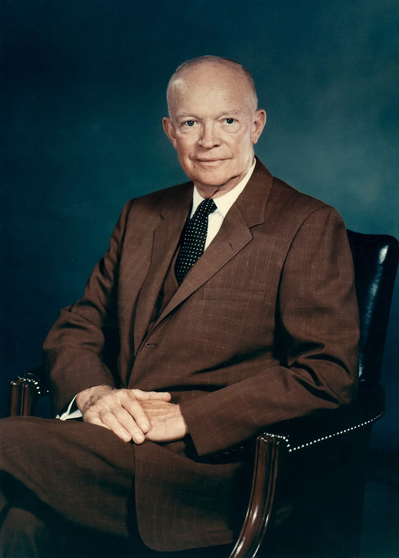
President Eisenhower signed the Federal-Aid Highway Act of 1956, formally the National System of Interstate and Defense Highways Act, on June 29, 1956, while recovering at Walter Reed Army Medical Center from surgery performed days earlier. The law authorized 41,000 miles of interstate highway and $25 billion in spending between 1957 and 1969, at the time the largest public works program in American history.
A companion measure, the Highway Revenue Act of 1956, created the Highway Trust Fund and set the federal government's share of construction cost at 90 percent, with states covering the remaining 10 percent, funded entirely by federal fuel and motor-vehicle taxes on a pay-as-you-go basis so the program would not add to the federal deficit.
The bill passed the Senate 89 to 1 and the House by a similarly lopsided margin. Because Eisenhower was hospitalized after surgery for what was then called ileitis, he signed it from his bed with no ceremony.
Missouri, Kansas, and Pennsylvania each claim credit for the first interstate work under the new law in 1956; Missouri's project on what is now Interstate 70 near St. Charles is the one most often cited as first.
In 1957, the American Association of State Highway Officials adopted the numbering scheme still used today. Primary routes running east-west carry even numbers that increase from south to north (Interstate 10 in the deep South, Interstate 90 near the Canadian border), while primary routes running north-south carry odd numbers that increase from west to east (Interstate 5 on the West Coast, Interstate 95 on the East Coast).
Three-digit auxiliary routes branch off a two-digit parent: an even first digit marks a loop or bypass that reconnects to its parent route at both ends, while an odd first digit marks a spur that dead-ends into a single point, typically a downtown business district.
The scheme deliberately reverses the older U.S. Route numbering, where low numbers sit in the north and east, so the two systems would not be confused where they overlap. Two-digit numbers ending in zero or five were reserved for the longest coast-to-coast and border-to-border routes.
Some places sit outside the ordinary grid: Hawaii's interstates carry an "H" prefix (H-1, H-2, H-3), Alaska's and Puerto Rico's federally funded expressways hold unsigned interstate designations, and Pennsylvania's I-99 was assigned its out-of-order number directly by an act of Congress in 1995.
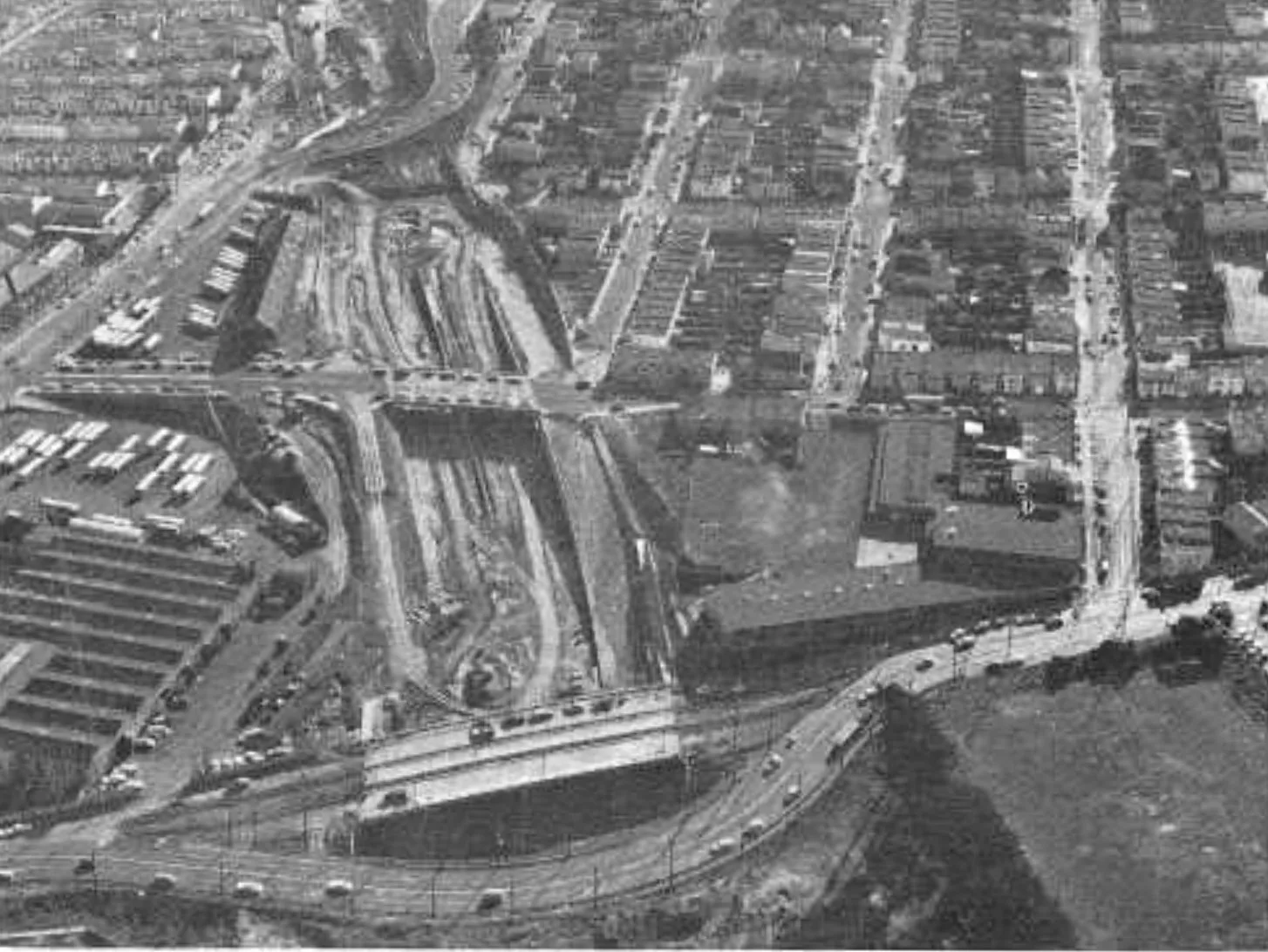
Construction moved fast in the years immediately after 1956: by the time Eisenhower left office in January 1961, roughly 10,440 miles, about 25 percent of the planned system, were already open to traffic, including dramatic engineering projects like the Mulholland Cut section of California's Interstate 405 through the Santa Monica Mountains, an eight-lane trench blasted through solid rock.
But costs climbed steadily past the original 1956 estimate as engineers encountered urban land acquisition costs, environmental compliance, and increasingly complex interchange designs that planners had not fully anticipated in the 1950s. Congress repeatedly extended deadlines and increased authorized spending throughout the 1960s and 1970s to keep the program funded as its true cost became clear.
The 25-billion-dollar figure proved far short almost immediately. Congress raised the gas tax to 4 cents in 1959, and by the early 1960s estimates for the full system had climbed past 40 billion dollars and kept rising, reaching roughly 76 billion by 1972.
This era also produced elevated urban viaducts that later generations spent billions to remove or bury, among them Boston's Central Artery, San Francisco's Embarcadero Freeway, and Seattle's Alaskan Way Viaduct.
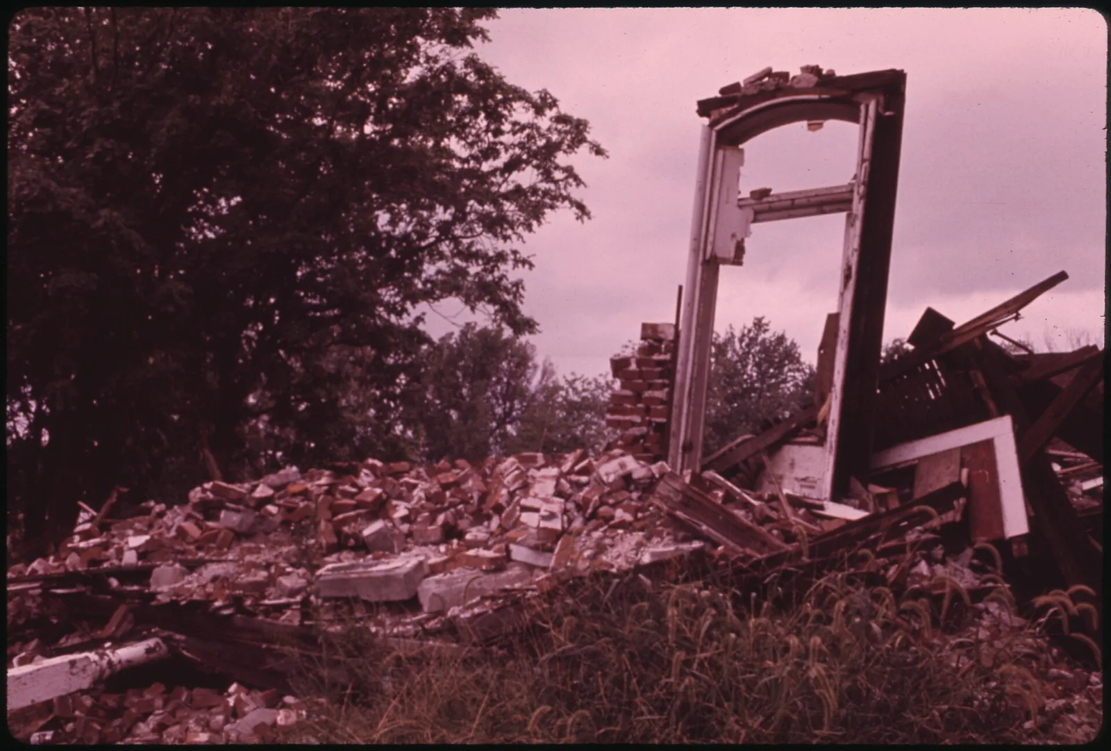
Unlike the rural stretches of interstate that mostly followed open land, urban interstates had to be cut directly through existing neighborhoods, and projects like the George Washington Bridge's second deck, completed in 1962, and hundreds of urban expressways nationwide reshaped city after city.
According to U.S. Department of Transportation estimates, highway construction displaced more than 475,000 households, over a million people, nationwide, and displacement fell disproportionately on Black and other minority neighborhoods that had less political power to resist a proposed route; entire communities such as Miami's Overtown and St. Paul's Rondo neighborhood were substantially demolished. In some wealthier and better-connected neighborhoods, most famously New York's Greenwich Village and New Orleans's French Quarter, organized 'freeway revolts' successfully blocked planned routes altogether, a contrast that remains one of the most studied aspects of the entire program.
Federal planning manuals of the 1950s actually encouraged routing expressways through areas officials labeled "blighted," treating highway building as a form of slum clearance, an approach later criticized for making displacement a goal rather than a side effect.
Cities have since spent heavily to undo parts of it: Boston buried its Central Artery in the Big Dig, Milwaukee tore out the Park East Freeway, San Francisco demolished the Embarcadero and Central freeways after the 1989 earthquake, and Rochester filled in a section of its Inner Loop.
Until the early 1960s, people displaced by federal highway projects were entitled to compensation for the property itself but had no legal right to help with moving expenses or finding a new home. Congress passed piecemeal relocation assistance programs starting in 1962, then consolidated and strengthened them with the Uniform Relocation Assistance and Real Property Acquisition Policies Act of 1970, which established consistent, nationwide rules requiring fair compensation, moving-expense reimbursement, and replacement-housing assistance for anyone displaced by a federally funded project.
The law remains the primary legal framework governing highway right-of-way acquisition today, though it arrived only after the most disruptive wave of urban interstate construction had already taken place.
The 1962 measure that preceded it had made moving-expense payments optional for each state and capped them at a few hundred dollars, so protection had been wildly uneven from place to place.
The 1970 Act made assistance mandatory and uniform across every federally funded program, not just highways, and it is carried out today under detailed rules in Part 24 of Title 49 of the Code of Federal Regulations, with the Federal Highway Administration as the lead agency.
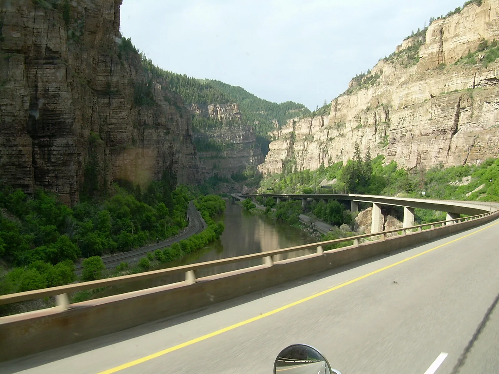
The last major piece of the originally planned interstate system was a 12-mile stretch of Interstate 70 through Colorado's Glenwood Canyon, a narrow gorge along the Colorado River that required three tunnels, roughly 40 bridges and viaducts, and 15 miles of retaining walls to build without destroying the canyon itself. Construction ran from 1980 to 1992 and cost $490 million, by far the most expensive stretch of rural interstate ever built.
On October 14, 1992, Federal Highway Administrator Thomas Larson joined Colorado officials to dedicate the completed segment, closing the last gap in the interstate route between Baltimore, Maryland, and Cove Fort, Utah, 36 years after Eisenhower signed the original 1956 Act and roughly triple its planned 12-year timeline.
The design won more than 30 engineering awards and is still cited as a model of "context-sensitive" highway design: much of the eastbound roadway is stacked on viaducts above the westbound lanes to keep the footprint narrow, and crews were barred from disturbing the riverbank.
Rockfall and debris remain a hazard. In 2021, mudslides off a wildfire burn scar closed the canyon stretch of I-70 for about two weeks, and the route has no practical detour shorter than roughly 200 miles.
The federal gas tax that funds the Highway Trust Fund has been frozen at 18.4 cents per gallon since 1993, and because it is a flat per-gallon rate rather than a percentage, inflation and improving vehicle fuel economy have steadily eroded its purchasing power; Congress has transferred about $275 billion from general federal revenue into the Trust Fund since 2008, including roughly $118 billion under the 2021 Infrastructure Investment and Jobs Act, just to keep it solvent.
Much of the original interstate pavement and bridge stock, now well past its originally engineered design life, requires an increasing share of spending simply for repair rather than expansion. The Infrastructure Investment and Jobs Act, signed into law in November 2021, directed roughly $110 billion in new funding toward roads, bridges, and major projects, including $40 billion specifically for bridge repair and replacement, the largest dedicated federal infrastructure investment since the original 1956 Act, aimed primarily at maintaining the system Eisenhower's generation built rather than expanding it.
Because electric vehicles pay no fuel tax at all, several states, including Oregon, Utah, and Virginia, have run pilot programs charging drivers by the mile instead, a possible long-term replacement for the gas tax.
The 2021 law also created a "Reconnecting Communities" grant program, the first federal money set aside to help cities remove or cap urban freeways that divided neighborhoods a half-century ago.
Who Pays, Who Builds, Who Maintains It
The interstate system is not a single federal project. It is 50 state highway programs, each following the same federal standards and drawing on the same dedicated trust fund.
A 90/10 Federal-State Partnership
States, not the federal government, own, design, and build interstate highways. Under the funding formula set in 1956, the federal government reimburses states for roughly 90 percent of an interstate project's cost from the Highway Trust Fund, while the state covers the remaining 10 percent along with the cost of acquiring right-of-way.
The Federal Highway Administration, part of the U.S. Department of Transportation, sets design standards and approves projects, but no federal agency directly employs the construction crews.
This structure was a deliberate choice. It built on the federal-aid system that had existed since 1916, in which Washington provides the money and the standards and the states do the work, and it avoided creating a large new federal construction agency.
The 90/10 split applied only to the original interstate construction. Most other federal-aid highway work, including interstate repair and reconstruction today, is funded at 80 percent federal and 20 percent state.
The Highway Trust Fund and the Gas Tax
The Highway Revenue Act of 1956 created the Highway Trust Fund and dedicated federal fuel taxes to pay for it, a deliberate pay-as-you-go design meant to keep the interstate program from adding to the federal deficit.
The federal gas tax itself dates to 1932, when it was created as a general 1-cent-per-gallon Depression-era revenue measure unrelated to roads. It was redirected to highway funding in 1956 and raised several times since, most recently to its current 18.4 cents per gallon in 1993; diesel is taxed separately at 24.4 cents.
Because the tax is a fixed number of cents rather than a percentage of price, its buying power has fallen for more than three decades as construction costs and vehicle fuel efficiency have both risen.
The fund now routinely spends more than it takes in. Congress has transferred about $275 billion from general revenue into it since 2008, and proposed long-term fixes range from raising or indexing the gas tax to replacing it with a per-mile charge.
Engineering Standards Set by AASHTO
Every interstate is built to standards published by the American Association of State Highway and Transportation Officials, commonly called the Green Book, which specifies minimum lane widths, shoulder widths, design speeds, and curve radii.
The defining feature of an interstate, full control of access, means traffic can only enter or exit at engineered interchanges; there are no traffic signals, stop signs, driveways, or at-grade railroad crossings anywhere on the mainline.
The standards call for 12-foot lanes, generally a right shoulder of at least 10 feet, a design speed of 50 to 70 miles per hour depending on terrain, and at least 16 feet of vertical clearance under bridges, set that high in part so oversized military equipment can pass.
Uniform signage, the red, white, and blue interstate shield, mile-based exit numbering, and standardized green guide signs, is governed by the Manual on Uniform Traffic Control Devices, so a driver sees the same conventions in every state, part of the original goal of a drive that does not change at state lines.
Who Actually Pours the Concrete
State departments of transportation design projects to federal standards, then competitively bid the work out to private construction companies, exactly as they do for any other state road project.
Federal Highway Administration division offices in each state review plans and inspect progress to confirm federal money is being spent on a project that meets federal standards, but the physical construction has always been carried out by private contractors working under state supervision, not by any federal construction agency.
Federal law generally requires the work go to the lowest responsive bidder, with wages set under the Davis-Bacon Act, and since the 1980s a share of contracts has been reserved for certified "disadvantaged business enterprises."
Large modern projects are increasingly delivered as "design-build," in which one team handles design and construction together, or as public-private partnerships in which a private firm finances and operates a stretch under a long-term concession, as with the Indiana Toll Road and Virginia's I-495 express lanes.
Who Maintains It Today
Routine maintenance, resurfacing, mowing, snow removal, and pothole repair, is primarily a state responsibility funded through a mix of state fuel taxes and annual federal-aid apportionments, rather than the same 90/10 formula used for new construction.
Bridges are inspected on a cycle set by the National Bridge Inspection Standards, generally at least once every two years, with more frequent inspections required for bridges in poor condition; in recent federal counts roughly 4 to 5 percent of interstate bridges have carried a "poor" rating.
As the system has aged well past its original mid-20th-century design life, generally about 20 years for pavement and 50 for bridges, an increasing share of both state and federal highway spending now goes toward rebuilding existing pavement and structures rather than building new interstate mileage.
The network has grown only modestly since it was declared substantially complete in 1992, from roughly 45,000 to about 48,000 miles, and almost all of that growth came from upgrading existing highways rather than building new corridors.
Reading the Numbers
Primary interstates use one or two digits: even numbers run east-west and increase from south to north, while odd numbers run north-south and increase from west to east, so a driver can tell a road's general direction and location from the number alone.
Numbers divisible by five were assigned to the longest through routes; roads like Interstate 5, Interstate 10, and Interstate 95 run coast to coast or border to border.
Three-digit auxiliary routes branch off a two-digit parent highway; an even first digit marks a loop or bypass that reconnects to the parent route at both ends, and an odd first digit marks a spur that terminates at a single point, typically a downtown business district.
The scheme deliberately reverses U.S. Route numbering to keep the two systems apart. A few oddities remain, such as Pennsylvania's I-99, whose number was fixed by an act of Congress in 1995 and sits well out of geographic order.
What It Has Cost Taxpayers
From a $6.8 million federal road in the 1810s to a $110 billion modern repair bill, figures below reflect publicly reported and federally sourced estimates, not fully itemized agency accounting.
| Item | Timeline | Reported Cost | Note |
|---|---|---|---|
| The National Road | 1806 to 1838 authorization period | About $6.8 million in federal appropriations | The first road ever built entirely with federal funds, an enormous sum for the era, though tiny compared to the interstate program that followed more than a century later. |
| Pennsylvania Turnpike (predecessor toll road) | 1938 to 1940 construction | About $70 million, a $41 million federal Reconstruction Finance Corporation loan plus a $29 million Public Works Administration grant | Not a federal-aid interstate project, but its financing model and engineering standard both directly influenced the system that followed. |
| Original 1956 Interstate Authorization | Authorized for 1957 to 1969 | $25 billion, 90 percent federal, 10 percent state | The largest public works authorization in American history at the time; the estimate proved dramatically low once the true scope of the project became clear. |
| Interstate System, substantially complete | 1956 to 1992, 36 years, triple the planned 12 | Roughly $114 billion in nominal dollars, about $425 billion in 2006 dollars | Figure widely cited by the Federal Highway Administration and transportation historians as the full construction cost of the originally authorized system. |
| I-70 Glenwood Canyon, Colorado, final link | 1980 to 1992 | $490 million for 12 miles | The single most expensive stretch of rural interstate ever built, due to three tunnels, roughly 40 bridges and viaducts, and 15 miles of retaining walls required to protect the canyon. |
| Highway Trust Fund general-revenue transfers | 2008 to present | About $275 billion transferred from general federal revenue since 2008 | Needed because the 18.4-cent federal gas tax, unchanged since 1993, no longer generates enough revenue on its own to cover the fund's obligations. |
| Infrastructure Investment and Jobs Act | Signed November 2021 | About $110 billion in new funding for roads, bridges, and major projects, including $40 billion for bridge repair and replacement | The largest dedicated federal infrastructure investment since the original 1956 Act, focused mainly on repairing the existing system rather than expanding it. |
Reshaping American Cities: The Displacement Debate
Presented neutrally, with the documented facts on both the human cost and the economic benefit of the system.
Rural interstate construction mostly followed open land and drew little sustained controversy, but urban interstate construction cut directly through existing neighborhoods, and the consequences were severe. The U.S. Department of Transportation has estimated that highway construction nationwide displaced more than 475,000 households and over a million people, with displacement falling disproportionately on Black and other minority communities that generally had less political power to resist a proposed route.
Well-documented examples include Miami's Overtown neighborhood, once a thriving Black business district largely demolished for Interstate 95 and connecting expressways, and St. Paul's Rondo neighborhood, split apart by Interstate 94. Historians studying this period have distinguished between two very different outcomes: an organized, well-resourced 'freeway revolt' in neighborhoods like New York's Greenwich Village and New Orleans's French Quarter that successfully blocked planned routes, and a much less visible pattern of demolition in neighborhoods that lacked the same political and financial standing to fight back.
Congress responded with the Uniform Relocation Assistance and Real Property Acquisition Policies Act of 1970, which established nationwide rules requiring fair compensation, moving-expense assistance, and replacement-housing help for anyone displaced by a federally funded project, rules that remain in effect today. Critics note the reform arrived only after the most disruptive decade of urban interstate construction had already occurred, and in recent years several cities, including Detroit, have begun removing or reconfiguring urban freeways built through historically Black neighborhoods, citing this history directly.
These are documented facts sourced to federal transportation data and academic research on the program's history, presented here for context. The Interstate Highway System's economic and logistical benefits, faster commerce, national defense mobility, and dramatically safer long-distance travel compared to the two-lane highways it replaced, are also well documented and are not in dispute; both sides of this history are part of the same program.
Did You Know?
A quick-reference set of facts drawn from the sourced material throughout this page.
- The system's official name is the Dwight D. Eisenhower System of Interstate and Defense Highways, a name Congress gave it in 1990 in his honor.
- A popular claim holds that federal law requires one mile in every five to be built straight enough to serve as a wartime aircraft runway. It's a myth; no such requirement exists in the 1944 or 1956 highway acts, though military logistics and civil defense were genuine considerations behind the system.
- The Interstate System makes up roughly 1 percent of all public road mileage in the United States but carries more than a quarter of all vehicle miles traveled nationwide, according to Federal Highway Administration data.
- Interstate 90, running from Seattle to Boston, is the longest interstate highway in the country at about 3,020 miles (FHWA).
- When Eisenhower left office in January 1961, less than five years after signing the 1956 Act, only about 10,440 miles of the planned 41,000-mile system, roughly 25 percent, were open to traffic.
- The federal gas tax has been frozen at 18.4 cents per gallon since 1993. Adjusted for inflation, that rate buys roughly half the paving and repair capacity today that it did when it was last set.
Sources & Further Reading
- The National Road, Federal Highway Administration
- Ask the Rambler: Was the Lincoln Highway the First Transcontinental Highway?, Federal Highway Administration
- 1919 Transcontinental Motor Convoy, Eisenhower Presidential Library
- Contributions and Crossroads: Our National Road System's Impact, Timeline, Federal Highway Administration
- Pennsylvania Turnpike Fact Sheet, Federal Highway Administration
- National System of Interstate and Defense Highways Act Signed Into Law, Library of Congress, Research Guides
- The Size of the Job, Federal Highway Administration, 50th Anniversary
- The Last Piece of the Interstate Highway System May Have Been the Toughest, American Society of Civil Engineers
- The Interstates and the Cities: Highways, Housing, and the Freeway Revolt, Poverty & Race Research Action Council
- How Interstate Highways Reinforced Segregation, HISTORY
- Right-of-Way, Uniform Relocation Act, Federal Highway Administration
- Claim That One in Every Five Miles of Interstate Must Be Straight for Planes to Land Is a Widespread Myth, PolitiFact
- Infrastructure Investment and Jobs Act: Highway Bridges, Congressional Research Service, Congress.gov