


About Idaho
The name Idaho has an unusual origin: it may have been invented. The most widely cited story holds that mining lobbyist George Willing proposed the name to Congress in 1860, claiming it was a Shoshone word meaning "gem of the mountains" or "the sun comes from the mountains." Congress initially rejected the name for the Colorado Territory but then applied it to a new territory in the Pacific Northwest in 1863. Later research suggests Willing may have simply made the name up or misrepresented its indigenous origins. Some historians believe the name may derive from a Shoshone word, while others remain skeptical. Whatever its true origin, Idaho became a state in 1890 and the name stuck.
Idaho is a state of superlatives hiding in plain sight. It has more miles of whitewater than any other state in the contiguous United States. It contains the largest wilderness area in the lower 48. It grows more potatoes than any other state in the country. It hosts one of the only American manufacturers of semiconductor memory chips in the world. And it has been one of the fastest-growing states in the nation for over a decade.
Idaho's geography is defined by the Snake River, which enters from Wyoming, carves a broad arc across the southern part of the state, plunges through Hells Canyon, the deepest river gorge in North America, and exits into Washington. The river irrigates the volcanic plain that grows Idaho's famous potatoes and hosts most of the state's population. North of the plain, the Sawtooth, Bitterroot, and Clearwater mountain ranges rise into some of the most remote wilderness in the country.
Idaho is politically among the most conservative states in the nation, reliably Republican in statewide and federal elections for decades. But the rapid influx of residents from more liberal West Coast states has introduced new political and cultural tensions into communities that had changed relatively little for generations.

Geography, Four Distinct Regions
Idaho's unusual shape, wide in the south, narrowing to the thin panhandle in the north, contains some of the most varied terrain in the American West.
Idaho's narrow northern panhandle, just 45 miles wide at its narrowest, is defined by dense old-growth forests, glacially carved lakes, and the Selkirk and Cabinet mountain ranges. Coeur d'Alene anchors the region, set on one of the most beautiful lakes in the Northwest. The Silver Valley east of Coeur d'Alene was once one of the world's richest silver mining districts.
Sandpoint, on Lake Pend Oreille, one of the deepest lakes in the US, is a popular resort and outdoor recreation destination. The panhandle observes Pacific Time, aligning with the economic pull of Spokane, Washington.
The panhandle exists because of a border compromise: in the 1880s Congress seriously weighed attaching it to Washington Territory or to Montana, and a rugged mountain spine still leaves the region tied more to Spokane, about 35 miles from Coeur d'Alene, than to Boise, a five-hour drive south. It is the only part of Idaho on Pacific Time.
The Bunker Hill mine and smelter at Kellogg, in the Silver Valley, ran from 1885 until 1981 and left behind one of the largest Superfund sites in the country, a roughly 1,500-square-mile area where the EPA has spent decades removing lead-contaminated soil from yards and hillsides. Coeur d'Alene, once a rough timber and mining town, is now one of the fastest-growing metro areas in Idaho, driven by retirees and remote workers priced out of the coast.
Central Idaho contains the Frank Church–River of No Return Wilderness, at 2.4 million acres, the largest contiguous wilderness area in the contiguous United States. The Sawtooth Mountains rise sharply from the valley floor with peaks over 10,000 feet, surrounding the Stanley Basin and the Salmon River, the longest free-flowing river contained within a single state in the lower 48.
Sun Valley, near Ketchum, is one of America's premier ski resorts, attracting elite visitors since the 1930s. Ernest Hemingway lived and died in Ketchum, and his grave is there.
Congress created the 756,000-acre Sawtooth National Recreation Area in 1972 after a proposed open-pit molybdenum mine at the foot of Castle Peak became a statewide political fight. The candidate who campaigned hardest against the mine, Cecil Andrus, won the governorship that year and went on to serve as U.S. Secretary of the Interior under President Carter.
The wolves that now range through central Idaho descend from animals the federal government reintroduced here and in Yellowstone in 1995 and 1996 over the state's strong objection; Idaho now counts a wolf population well above 1,000 and has authorized expanded hunting and trapping to cut it back. Salmon and steelhead still swim more than 900 miles from the Pacific and climb over 6,000 feet to spawn in the Stanley Basin, one of the longest and highest fish migrations on Earth.
The Snake River cuts a broad arc across southern Idaho, carving a fertile agricultural plain through an otherwise arid landscape. This is potato country, the volcanic soil, high elevation, and cool nights of eastern Idaho's Snake River Plain produce conditions ideal for growing some of the world's best potatoes. Boise, at the western end of the plain, has transformed from a regional government town into a booming technology hub.
Twin Falls, Pocatello, and Idaho Falls anchor the eastern corridor. Shoshone Falls on the Snake River, taller than Niagara Falls, sits in this region.
The plain is the track of the Yellowstone hotspot. Over roughly 16 million years the North American plate drifted southwest across the stationary plume, which burned a chain of giant volcanic calderas from the Oregon border to Yellowstone; the collapsed calderas later filled with sediment and lava to form the flat, farmable crescent. The Eastern Snake River Aquifer beneath it, among the largest in the country, supplies most of the region's irrigation and drinking water.
Boise, founded in 1863 beside the Oregon Trail and a new Army fort, now has around 240,000 residents in the city and more than 800,000 in the metro, and it has ranked repeatedly among the fastest-growing metro areas in the nation since 2015. Twin Falls sits on the rim of the Snake River Canyon that daredevil Evel Knievel tried and failed to jump on a steam-powered rocket cycle in September 1974.
Eastern Idaho sits at the edge of the Yellowstone volcanic system. Craters of the Moon National Monument, a vast lava field covering 618 square miles, looks so otherworldly that NASA sent Apollo astronauts here to train for moon landings.
Hells Canyon, on Idaho's western border with Oregon, is the deepest river gorge in North America, deeper than the Grand Canyon at 7,993 feet. The Idaho Falls and Blackfoot areas are major agricultural centers and home to the Idaho National Laboratory, one of the nation's premier nuclear energy research facilities.
Craters of the Moon's youngest lava flows are only about 2,000 years old, and geologists expect the Great Rift that fed them to erupt again within the next thousand years. The Idaho National Laboratory, set up as the National Reactor Testing Station in 1949, spreads across an 890-square-mile section of the desert plain, an area larger than the state of Rhode Island.
The region still carries the scar of the Teton Dam failure. On June 5, 1976, the newly filled earthen dam on the Teton River gave way, sending a wall of water through Rexburg and Sugar City that killed 11 people and roughly 13,000 head of livestock and caused up to two billion dollars in damage; the dam was never rebuilt. Eastern Idaho is also the most heavily Latter-day Saint part of the state, the northern end of the Mormon settlement corridor that runs up from Utah.

Economy
Idaho's economy blends deep agricultural roots with a fast-growing technology sector, world-class outdoor recreation, critical nuclear research, and rare-gem mining, a diversity unusual for a state of its size.
Idaho produces roughly 30% of all potatoes grown in the United States, more than any other state, with the Snake River Plain's volcanic soil, irrigation water, and high-altitude climate creating near-ideal conditions. Idaho is also a leading dairy state, consistently ranking in the top five nationally for milk production.
The state raises 75% of all commercially farmed rainbow trout in the country. Barley, wheat, hops, sugar beets, and seeds round out an agricultural sector that generates billions annually.
Idaho harvests roughly 300,000 acres of potatoes a year, on the order of 13 billion pounds. The J.R. Simplot Company of Boise, which perfected commercial frozen french fries in the 1940s and became the main potato supplier to McDonald's, built one of the West's great private fortunes on that crop, and the word 'Idaho' on potatoes is a federally registered certification mark the state controls.
Milk has quietly passed potatoes as Idaho's most valuable farm product. About 650,000 dairy cows are concentrated in the Magic Valley around Twin Falls, where Chobani opened what it calls the world's largest yogurt plant in 2012. The dairy boom has fueled long-running fights over groundwater pumping from the Snake River Aquifer and over the mostly immigrant workforce that milks the herds.
Micron Technology, headquartered in Boise since 1978, is one of only three companies in the world, and the only American one, that manufactures DRAM semiconductor memory chips at scale. As global competition for chip manufacturing has intensified, Micron's Idaho operations have become critical to U.S. national security strategy.
Beyond Micron, Boise has attracted a growing tech sector including Hewlett Packard's printer division (now HP Inc.), Clearwater Paper, and a surge of startups and tech workers relocating from California.
Micron was started in 1978 by twin brothers Joe and Ward Parkinson with seed money from Idaho potato magnate J.R. Simplot, and it is the only Fortune 500 company headquartered in the state. It remains one of just three large makers of DRAM memory worldwide, alongside Samsung and SK Hynix of South Korea, and it also owns the Crucial consumer brand.
In 2022 Micron announced a roughly 15-billion-dollar new memory fab beside its Boise campus, its first new leading-edge memory plant built in the United States in two decades, timed to incentives from the federal CHIPS and Science Act, along with a far larger complex planned for upstate New York. The following year China's cyberspace regulator barred Micron chips from critical domestic infrastructure, and the company warned the ban could cost it a low-double-digit share of annual revenue.
Sun Valley near Ketchum was America's first destination ski resort, opened in 1936 by Union Pacific Railroad. Today it remains one of the most exclusive ski destinations in the country. The Salmon River offers world-class whitewater rafting through some of the most remote wilderness in the nation.
Coeur d'Alene is a premier lake resort destination. The state's hunting and fishing traditions, cutthroat trout, elk, and mule deer, attract sportsmen from across the country. Tourism generates over $3 billion annually.
Union Pacific chairman Averell Harriman built Sun Valley in December 1936 largely to give his railroad a glamorous destination to sell tickets to, and the resort installed the world's first chairlift that winter, its engineers adapting a rig used to load bananas onto ships. Ernest Hemingway finished 'For Whom the Bell Tolls' in a room at the Sun Valley Lodge in 1939 and is buried in the Ketchum cemetery.
The Middle Fork of the Salmon, about 100 miles of river through the Frank Church wilderness with no roads and no bridges, is one of the most coveted multi-day float trips in the country, its launch permits handed out by lottery. Federal Bureau of Economic Analysis figures put the outdoor recreation economy in Idaho at roughly 7 billion dollars a year, supporting tens of thousands of jobs.
The Idaho National Laboratory near Idaho Falls is the nation's leading center for nuclear energy research and development, operated by the U.S. Department of Energy. The site hosts over 50 nuclear reactors, more than anywhere else in the world, and was the location of the first nuclear reactor to generate usable electricity (EBR-1, 1951).
The lab employs thousands of scientists and engineers and is central to the Biden and Trump administrations' nuclear power strategies for clean energy and national security.
On December 20, 1951, Experimental Breeder Reactor I near Arco lit a string of four light bulbs, the first useful electricity ever generated from nuclear fission, and in 1955 Arco briefly became the first town in the world powered by nuclear energy in a planned demonstration. EBR-I is now a national historic landmark that visitors can tour.
The site also holds a somber distinction: the January 1961 explosion of the small SL-1 military reactor killed three technicians, the only fatal reactor accident in U.S. history, and drove lasting changes in reactor design and operator training. Today the lab is the lead site for the Department of Energy's advanced-reactor program, and companies including NuScale have proposed building small modular reactors on the desert grounds.
Idaho is one of only two places on Earth where star garnets, a rare gemstone displaying a six-pointed star, are found in significant quantities (the other is India). The Coeur d'Alene Mining District in the Silver Valley produced more silver than any other mining district in U.S. history.
Idaho also produces cobalt, phosphate (used in fertilizers), and molybdenum. Timber harvesting from Idaho's vast national forest lands has historically been a major industry, though environmental regulations have significantly reduced logging activity.
The Coeur d'Alene district has yielded more than 1.2 billion ounces of silver since the 1880s, more than any other district in the world, and the Lucky Friday and Galena mines still operate. The Sunshine Mine fire near Kellogg in May 1972 killed 91 miners, one of the worst hard-rock mining disasters in American history, and helped push Congress to pass the Federal Mine Safety and Health Act of 1977.
Idaho holds most of the known U.S. reserves of cobalt, a metal critical to electric-vehicle batteries; a mine in the Salmon River Mountains reopened in 2022 as the only primary cobalt mine in the country before pausing on weak prices. In the state's southeast, phosphate mined for fertilizer has left a legacy of selenium contamination that has sickened livestock and fouled streams, keeping several sites on the federal cleanup list.

How Idaho's State Government Works
Idaho operates a three-branch state government. The Idaho Legislature consists of a 35-member Senate and a 70-member House of Representatives, both chambers have been dominated by Republicans for decades. Idaho has no term limits for state legislators, though the governor is limited to two consecutive four-year terms.
Idaho is one of the most reliably Republican states in the country. It has not voted for a Democratic presidential candidate since Lyndon Johnson in 1964 and has not elected a Democratic governor since Cecil Andrus left office in 1995. The state Republican Party has often featured internal divisions between its establishment and more conservative wings, primaries are frequently more competitive than general elections.
Federal land ownership is a defining political issue in Idaho: the federal government owns about 62% of Idaho's land area, the second-highest share of any state, including vast national forests, wilderness areas, and Bureau of Land Management lands. Debates over grazing rights, logging, mining, and recreation on federal land are perennial flashpoints in state politics.
Governor of Idaho
Current Governor
Brad Little

- Party
- Republican
- In Office Since
- January 7, 2019
- Elected
- 2018, re-elected 2022
- Term Ends
- January 2027
- Born
- February 15, 1954, Emmett, Idaho
- Background
- Rancher, businessman, and fourth-generation Idahoan
- Prior Role
- Idaho Lieutenant Governor (2009–2019)
Brad Little is the 33rd Governor of Idaho. A fourth-generation Idahoan, sheep rancher, and businessman from Emmett, he served a decade as Lieutenant Governor before winning the governorship. He has focused on economic development, education funding, property tax relief, and managing Idaho's explosive population growth while preserving the state's rural character.
Other Current State Officials
Lieutenant Governor
Scott Bedke
In office since January 2023. Former Speaker of the Idaho House of Representatives. Focuses on agriculture, water rights, and rural economic policy.
Attorney General
Raúl Labrador
In office since January 2023. Former U.S. Representative (2011–2019) and co-founder of the House Freedom Caucus. Focus on constitutional originalism and federal land disputes.
Secretary of State
Phil McGrane
In office since January 2023. Former Ada County Clerk. Focuses on election administration, voter access, and records modernization.
The Idaho State Legislature
Idaho State Senate
- Seats: 35 members
- Terms: 2-year terms
The upper chamber. Idaho is one of the few states where senators serve 2-year terms, meaning every legislator in both chambers faces voters at the same time. Idaho has 35 legislative districts, each electing one senator and two representatives.
Idaho House of Representatives
- Seats: 70 members
- Terms: 2-year terms
The lower chamber. Each of Idaho's 35 districts elects two House representatives, for a total of 70 members. With both chambers on 2-year terms, all 105 Idaho legislators face voters simultaneously every election cycle.
Idaho's U.S. Senators
U.S. Senator
Mike Crapo
One of the longest-serving senators in Idaho history. A former U.S. Representative, Crapo has served in the Senate since 1999 and chairs the Senate Finance Committee, one of the most powerful positions in Congress, with jurisdiction over taxes, trade, and Social Security. Known for bipartisan work on financial regulation and deficit reduction.
U.S. Senator
Jim Risch
Former Governor of Idaho (2006–2007) and Lieutenant Governor. Has served in the Senate since 2009 and has chaired the Senate Foreign Relations Committee since January 2025. Focuses on national security, energy policy, and western water rights. Known for his hawkish foreign policy positions.
Idaho Through the Years
From early settlement to the present day. Tap any era to read more.
Long before European contact, Idaho was home to dozens of Indigenous nations. The Nez Perce, Niimíipuu in their own language, occupied the central and northern regions, building a sophisticated culture around fishing, hunting, and trade. They bred the Appaloosa horse, now Idaho's state animal, and developed extensive trade networks stretching from the Pacific Coast to the Great Plains.
The Shoshone and Bannock dominated the Snake River Plain. The Coeur d'Alene, Kootenai, and Pend d'Oreilles inhabited the northern lake country.
The Appaloosa is named for the Palouse River country of the Nez Perce, who were among the first Native peoples in the region to breed horses selectively after acquiring them in the early 1700s. In 1863, after gold was found on Nez Perce land, U.S. negotiators pushed through a treaty, remembered by the tribe as the 'Thief Treaty,' that cut the reservation by about 90%; the bands that had not signed it, including Chief Joseph's, refused to recognize it.
The Bear River Massacre of January 29, 1863, in which U.S. Army troops under Colonel Patrick Connor killed an estimated 350 to 500 Northwestern Shoshone, most of them women and children, near present-day Preston, is considered the deadliest single attack on Native people in U.S. history. Five federally recognized tribes hold land in Idaho today, among them the Shoshone-Bannock Tribes on the Fort Hall Reservation near Pocatello and the Nez Perce near Lapwai.
The Lewis and Clark Expedition crossed the Bitterroot Mountains into Idaho in September 1805, one of the most grueling stretches of their entire journey. Exhausted, cold, and nearly out of food, they descended to the Weippe Prairie where they encountered the Nez Perce. The Nez Perce fed the starving expedition, cared for their horses, and provided guides and canoes to continue west to the Pacific.
Without Nez Perce assistance, the expedition would likely have failed. Clark carved his name into a ponderosa pine near Orofino, the mark can still be seen today.
The crossing of the Lolo Trail over the Bitterroots, about 11 days in mid-September 1805, was the hardest single stretch of the entire journey. Early snow and no game forced the men to eat portable soup, candle tallow, and three of their own colts, and they named one campsite Colt Killed Creek.
Tribal tradition credits a Nez Perce woman remembered as Watkuweis, who had once been treated kindly by white traders in Canada, with urging her people not to kill the vulnerable strangers. The Nez Perce kept the expedition's roughly three dozen horses through the winter of 1805-1806 and returned nearly all of them the next spring, a show of good faith the tribe would recall with bitterness after the 1877 war.
Gold discoveries in the Clearwater and Boise Basin regions in the early 1860s triggered rapid settlement, bringing thousands of prospectors and establishing Idaho Territory in 1863. Simultaneously, Mormon settlers from Utah were pushing north into southeastern Idaho, establishing agricultural communities in the Snake River Plain.
These two settlement streams, the rough mining camp culture of the north and the organized agricultural settlements of the south, created a cultural division that still echoes in Idaho politics today.
Elias Davidson Pierce found gold on Nez Perce land along the Clearwater in 1860, and within two years the strikes at Lewiston, Florence, and the Boise Basin drew tens of thousands; Idaho City briefly became the largest town in the Pacific Northwest. Chinese miners were more than a quarter of the territory's population by 1870 and were subjected to special taxes and, in several camps, violent expulsion.
Mormon pioneers founded Franklin in 1860, Idaho's first permanent non-Native town, at first believing they were still inside Utah. Hostile territorial legislators passed the Idaho Test Oath in 1884, barring anyone who believed in or belonged to a church that practiced plural marriage from voting or holding office; the U.S. Supreme Court upheld it in Davis v. Beason (1890), and the provision stayed in the state constitution until voters finally removed it in 1982.
Idaho was admitted to the Union on July 3, 1890, one day before Wyoming, making it the 43rd state. Statehood came after years of territorial status and intense debate over Idaho's borders.
The state entered the Union with an economy built on mining and ranching, a small population scattered across enormous distances, and contentious unresolved disputes with Native American nations over land and treaty rights, particularly with the Nez Perce, who had fought and lost a war with the U.S. Army in 1877.
Idaho nearly did not survive as one territory. A serious push in the 1880s would have split it, attaching the panhandle to Washington and the south to Nevada, and it was stopped only by a pocket veto from President Grover Cleveland in 1887. The territorial capital had already moved from Lewiston to Boise in 1865, a transfer the northern counties resented and briefly fought in court.
The 1889 constitutional convention wrote the anti-Mormon test oath into the founding document and, more lastingly, enshrined the arid-West water rule of 'first in time, first in right,' which still governs how Idaho allocates its rivers. Idaho entered the Union with about 88,000 people, and for its first two decades its politics were dominated by mining companies and their violent conflicts with the Western Federation of Miners.
In late August 1910, a series of wildfires across Idaho, Montana, and Washington merged into a single catastrophic inferno, driven by hurricane-force winds, that burned 3 million acres in just two days and killed 85 people, most of them firefighters. The 'Big Blowup' was the largest wildfire in recorded American history.
The disaster galvanized the young U.S. Forest Service and shaped American fire policy for a century: the agency adopted a policy of suppressing all fires as quickly as possible, a policy that later contributed to the build-up of fuels now driving the catastrophic fire seasons of the modern era.
The mining town of Wallace lost about a third of its buildings, and smoke from the fires darkened skies as far east as New England and dropped soot on the Greenland ice sheet. Forest ranger Ed Pulaski saved most of his 45-man crew by holding them at gunpoint inside an abandoned mine tunnel near Wallace while the fire roared over them; five men still died.
Pulaski went on to design the combined axe-and-hoe hand tool that carries his name and is still standard equipment on every wildland fire crew. The 1910 fires convinced Congress to fund the Forest Service generously and hardened a total-suppression doctrine, later codified as the '10 a.m. policy' in 1935, that governed forest management for decades and, many fire ecologists now argue, set the stage for today's megafires.
Idaho has been one of the fastest-growing states in the country for over a decade, driven primarily by migration from California, Oregon, and Washington. Boise's combination of outdoor access, lower costs, a growing tech sector, and conservative politics has attracted waves of transplants.
The city's population has grown by over 20% in a decade. The rapid growth has transformed Boise's housing market, strained infrastructure, and sparked political debates about land use, water rights, and Idaho's cultural identity, as longtime residents grapple with changes brought by newcomers.
By the Census Bureau's count Idaho was the fastest-growing state in the nation by percentage in both 2020 and 2021, and it added more than 270,000 people over the 2010s, a roughly 17% jump. The Boise metro, made up of Ada and Canyon counties, took most of that growth and pushed past 800,000 residents.
The inflow, heavily from California and the Pacific Northwest, drove the median Boise-area home price above 500,000 dollars by 2022, close to double what it had been five years earlier, and coincided with sharp rises in homelessness and in political friction over growth. The migration also drew national attention to the 'American Redoubt,' a movement launched in 2011 that urges conservative Christians to relocate to Idaho and the interior Northwest.
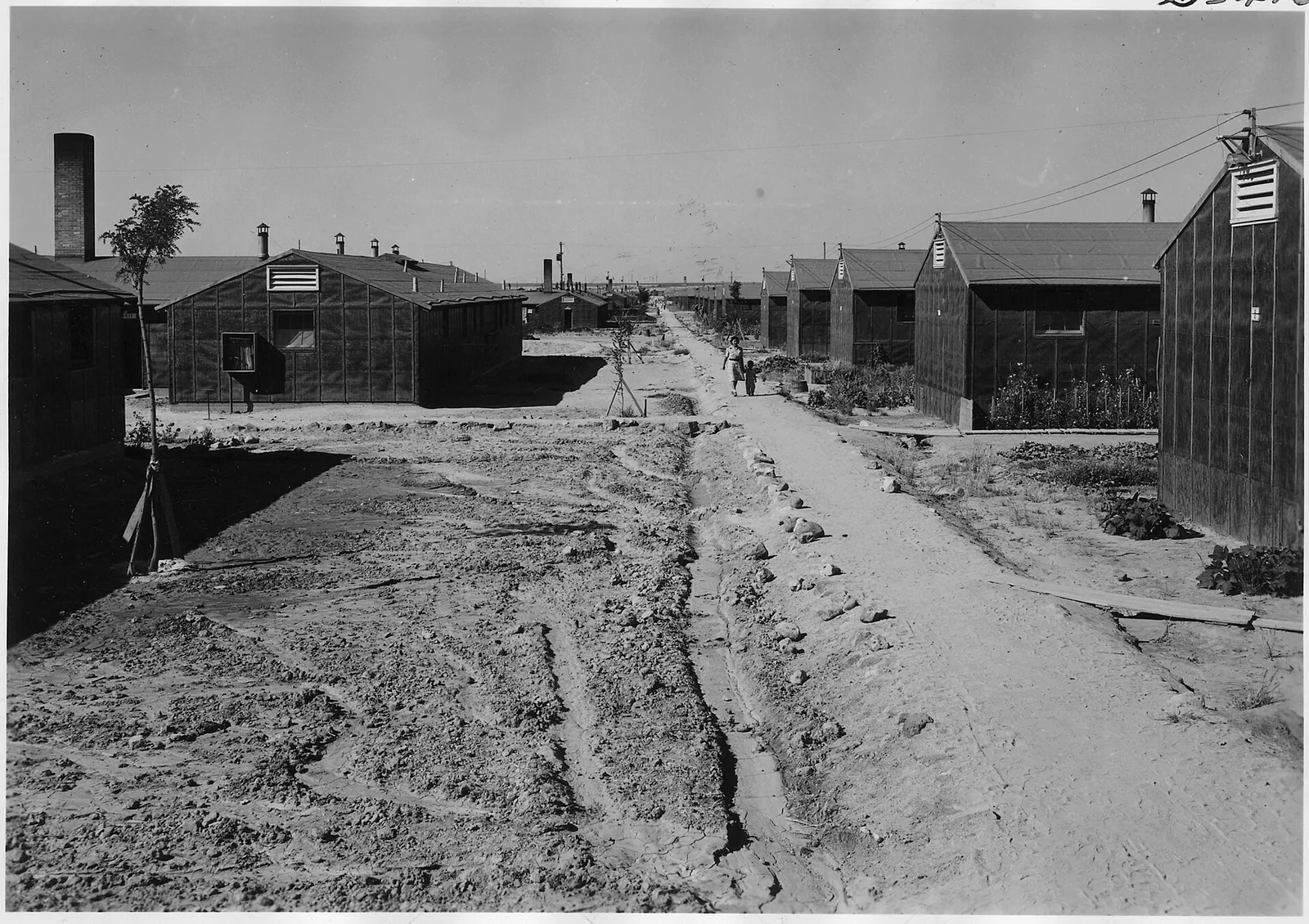
Idaho's Defining Moments in American History
These are the events that didn't just shape Idaho, they changed the nation.
The Nez Perce War of 1877 is one of the most heartbreaking episodes in American history. When the U.S. government attempted to force the Nez Perce onto a reservation a fraction the size of their homeland, Chief Joseph and a band of about 800 men, women, and children fled, attempting to reach Canada.
They outmaneuvered U.S. Army forces across 1,170 miles of terrain through Idaho, Montana, and Wyoming before being stopped 40 miles from the Canadian border. Chief Joseph's surrender speech, 'From where the sun now stands, I will fight no more forever', remains one of the most eloquent statements of defeat and dignity in American literature.
The fighting began in June 1877 when, after the deadline to move onto the shrunken reservation, a few young warriors killed white settlers along the Salmon River in revenge for earlier murders, and the Army gave chase. Over about four months the non-treaty bands, with fewer than 250 fighting men slowed by families and horse herds, fought roughly 18 engagements, including a sharp Army defeat at White Bird Canyon and a deadly dawn attack on their sleeping camp at the Big Hole in Montana.
The bands finally surrendered to Generals Howard and Miles at the Bear Paw Mountains on October 5, 1877, about 40 miles short of the Canadian line where Sitting Bull's Lakota had taken refuge. Rather than being sent home to Idaho as they had been promised, the roughly 400 survivors were shipped to Kansas and then Indian Territory in Oklahoma, where many died of disease; the remnant was allowed back to the Northwest only in 1885, and Chief Joseph died on the Colville Reservation in Washington in 1904.
The Frank Church–River of No Return Wilderness, designated in 1980 and named after Idaho's legendary Senator Frank Church who championed the Wilderness Act, is the largest contiguous wilderness area in the contiguous United States at 2.4 million acres. No roads cross it.
It contains the Salmon River, the longest free-flowing river contained within a single state in the lower 48, and some of the deepest river canyons in North America. It represents the largest expression of America's wilderness ideal: land set aside forever, unchanged, for its own sake.
Frank Church represented Idaho in the U.S. Senate from 1957 to 1981 and was floor manager of the 1964 Wilderness Act. He also chaired the 1975-76 Senate committee, known as the Church Committee, that exposed CIA assassination plots and decades of illegal domestic surveillance, work that led to the permanent congressional intelligence-oversight committees and the FISA court.
Congress renamed the combined River of No Return and Idaho Primitive areas for Church in 1984, a few months before he died of cancer. At roughly 2.37 million acres it is still the largest wilderness in the lower 48 states; a handful of backcountry airstrips and pre-existing ranches and lodges are grandfathered inside its boundaries, but no new roads, buildings, or motor vehicles are permitted.
Founded in a Boise basement in 1978, Micron Technology grew into one of the world's largest semiconductor manufacturers. As the United States has grappled with its dependence on Asian chip manufacturing, a vulnerability exposed by COVID-era supply chain disruptions, Micron's Idaho factories have become a symbol of domestic semiconductor resilience.
The 2022 CHIPS and Science Act directed billions toward expanding domestic production, with Micron's Idaho operations at the center of the strategy to reclaim American leadership in the technology that powers everything from smartphones to F-35 fighters.
Micron now employs roughly 8,000 people in the Boise area and around 48,000 worldwide, and it is the last U.S.-headquartered maker of DRAM after a wave of consolidation drove American rivals such as Texas Instruments and IBM out of the memory business in the 1980s and 1990s. It also runs a large plant in Manassas, Virginia, and sells consumer products under the Crucial brand.
The planned Boise fab, expected to cost around 15 billion dollars through the end of the decade and to add about 2,000 direct jobs, broke ground in 2023 as the first new memory-manufacturing site built in the United States in 20 years. Micron's results still swing with a brutally cyclical commodity market and with U.S.-China tensions: after Beijing's 2023 ban on its chips in critical infrastructure, the company said it could lose a low-double-digit share of annual revenue.
Notable Idahoans
Ezra Pound
Influential modernist poet, born in Hailey
Philo Farnsworth
Inventor of the electronic television system, conceived the idea while farming near Rigby at age 14
Frank Church
U.S. Senator who led landmark Senate intelligence oversight hearings in the 1970s, born in Boise
Harmon Killebrew
Baseball Hall of Fame slugger, born in Payette
Picabo Street
Olympic gold medalist alpine skier, born in Triumph
Sacagawea
Shoshone woman who guided the Lewis and Clark Expedition through the Pacific Northwest
State Symbols & Quick Facts
| Nickname | "The Gem State" |
| Capital | Boise |
| Largest City | Boise |
| Statehood | July 3, 1890 (43rd state) |
| Population | ~2.0 million (2025 est.), one of the fastest-growing states |
| Area | 83,569 sq mi, 14th largest state |
| Motto | Esto Perpetua (Let It Be Perpetual) |
| State Bird | Mountain Bluebird |
| State Flower | Syringa (Mock Orange) |
| State Tree | Western White Pine |
| State Animal | Appaloosa Horse |
| State Fish | Cutthroat Trout |
| State Gem | Star Garnet (found almost nowhere else on Earth) |
| State Song | "Here We Have Idaho" |
| Time Zone | Mountain Time (most of state) / Pacific Time (northern panhandle) |
| Borders | Montana & Wyoming (E), Nevada & Utah (S), Oregon & Washington (W), Canada, British Columbia (N) |
Did You Know?
Idaho has more miles of whitewater than any other state in the contiguous United States, over 3,100 miles, including the Salmon, Snake, and Clearwater. The Salmon River is the longest free-flowing river contained within a single state in the lower 48 states.
Craters of the Moon National Monument looks so much like the lunar surface that NASA sent Apollo 14 astronauts, including Alan Shepard, to Idaho to train for moon landings in 1969. The lava fields are younger than 15,000 years old.
Hells Canyon on Idaho's western border is the deepest river gorge in North America, at 7,993 feet deep, it is deeper than the Grand Canyon. The Snake River carved it over millions of years through hard basalt rock.
Idaho is home to one of the largest elk herds in the continental United States, second only to Colorado's. The state's vast wilderness and national forest lands support an estimated 100,000 to 120,000 elk, drawing hunters from across the country every fall.
Ernest Hemingway spent his final years in Ketchum, Idaho, in the shadow of the Sawtooth Mountains and near Sun Valley ski resort. He died there in 1961 and is buried in the Ketchum Cemetery, where his grave remains a pilgrimage site for literary fans.
Quick Facts and Common Questions
Short answers to the questions people most often ask about Idaho: its abbreviation, where its name came from, its capital, and its place in Congress.
Idaho's two-letter postal abbreviation is ID. The U.S. Census Bureau places it in the West region, in the Mountain division, and about 1.84 million people lived there in the 2020 census.
Idaho became the 43rd state on July 3, 1890. Its land became undisputed U.S. territory under the 1846 Oregon Treaty with Great Britain, and Congress created the Idaho Territory on March 4, 1863.
The meaning is uncertain. A popular story says it is a Shoshone phrase meaning "gem of the mountains," but historians have found no support for that, and the name may have been coined in the 1860s. Another explanation traces it to a Plains Apache word for the Comanche. The "gem" story still gave Idaho its nickname, "The Gem State."
Boise has been the capital since 1865. The first territorial capital was Lewiston, in the north, from 1863 until the legislature moved it to Boise, a decision that angered many northern residents. The current State Capitol was completed in 1920.
Idaho borders six states: Montana and Wyoming to the east, Utah and Nevada to the south, and Oregon and Washington to the west. At the top of its narrow northern panhandle it borders the Canadian province of British Columbia.
Idaho's motto is "Esto Perpetua," Latin for "Let It Be Perpetual." Its state bird is the mountain bluebird, its flower is the syringa, its tree is the western white pine, and its state horse is the Appaloosa.
Based on the 2020 census, Idaho has 2 seats in the U.S. House of Representatives, the same as before, which gives it 4 votes in the Electoral College.
On December 20, 1951, Experimental Breeder Reactor-I, at the federal reactor testing station in the Idaho desert, became the first reactor to generate usable electricity from nuclear energy, lighting four light bulbs. In 1955 the nearby town of Arco became the first community powered by nuclear energy. The site is now Idaho National Laboratory.
Hells Canyon, carved by the Snake River along the Idaho-Oregon border, is the deepest river gorge in North America, about 7,900 feet deep at its deepest point. It is protected as the Hells Canyon National Recreation Area.
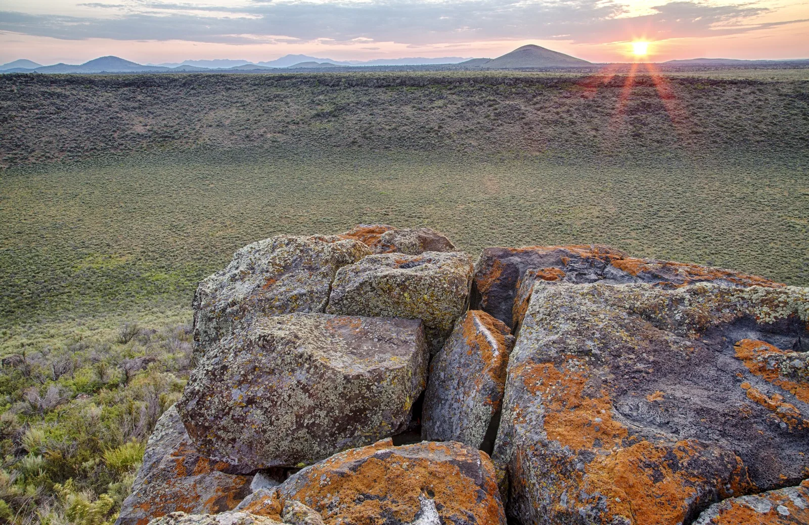
Craters of the Moon National Monument
A Sea of Lava Covering 618 Square Miles of Southern Idaho
About Craters of the Moon National Monument
Craters of the Moon National Monument and Preserve protects one of the largest and youngest basalt lava fields in the lower 48 states, a black expanse of flows, cinder cones, and lava tubes on the Snake River Plain of southern Idaho.
The lava came not from a single volcano but from the Great Rift, a system of fissures up to 52 miles long and, in places, more than 800 feet deep, believed to be the deepest open rift cracks known anywhere on Earth.
Geologists count eight eruptive periods over the past 15,000 years, each lasting centuries and separated by quiet spells of roughly 2,000 years; the last flows are about 2,100 years old, and another eruption is expected within the next 1,000 years.
President Coolidge proclaimed the monument on May 2, 1924, after the explorer Robert Limbert publicized the area in National Geographic; President Clinton expanded it more than tenfold in 2000, and Congress made the addition a national preserve, open to hunting, in 2002. NASA sent Apollo astronauts here in 1969 for geology field training among the volcanic features.
- Designation
- National Monument and Preserve
- Location
- Blaine, Butte, and Power Counties, Idaho
- Established
- 1924
- Annual Visitors
- ~250,000
The Volcanic Landscape
Fountaining eruptions along the Great Rift threw frothy lava into the air that fell back as cinders, piling up cones 300 to 800 feet high; Big Cinder Butte is one of the largest purely basaltic cinder cones on Earth.
Spatter cones formed where thicker, gassier lava was tossed out in clots that welded together around a vent into steep-sided chimneys, several of which line the loop road.
Inferno Cone is a short, steep climb up loose black cinders to a summit view over the whole lava field and out to the Pioneer and Lost River ranges.
The cones erupted along a line, so from the air they trace the buried fissure of the rift itself, a pattern Limbert's photographs first made clear.
Lava tubes formed when the surface of a fast pahoehoe flow crusted over while molten rock kept running underneath, then drained away and left a tunnel.
Indian Tunnel, the largest open to the public, runs about 800 feet with collapsed skylights that light the floor, so no flashlight is needed; Dewdrop, Boy Scout, and Beauty caves are smaller and darker.
The caves act as cold traps, holding winter air all year, and some keep floor ice through the hot Idaho summer.
A free permit is required to enter any cave, and visitors must confirm they have not worn the same clothing or gear in another cave, a precaution against carrying the white-nose fungus to the resident bats.
Pahoehoe lava has a smooth, ropy, billowy skin, formed when a slow-moving flow keeps a flexible crust; some pahoehoe here is glassy enough to reflect the sky.
A'a lava is a jumble of sharp, clinkery rubble, formed when a stiffer or faster flow tears its own crust apart as it moves; crossing it on foot shreds ordinary shoes.
Both are basalt and both are black when fresh, but the older surfaces weather to rusty brown and blue-gray, and lichens slowly stain them orange and green.
The monument is compact enough that a visitor can walk from fresh-looking pahoehoe to 15,000-year-old flows and read the whole aging sequence in an afternoon.
Plants colonize the lava from cracks and cinder pockets that trap wind-blown soil, and over thousands of years hundreds of species have taken hold.
Limber pine is the main tree, its flexible branches and deep crack-following roots suited to bare rock; some on the flows are several centuries old.
Dwarf buckwheat grows in an evenly spaced polygonal pattern across the cinders, each plant's roots claiming a circle of scarce moisture, a natural spacing often mistaken for deliberate planting.
The monument holds a distinct low-elevation population of pikas living in the cool lava, along with more than 300 plant species and a brief spring bloom that turns the black cinders pink and yellow.
Indigenous Connections
Shoshone-Bannock Tribes
Shoshone and Bannock people crossed and camped along the edges of the lava field for centuries, using the Great Rift corridor and the surrounding plain as a travel and hunting route between the Snake River and the mountains.
The area gave up obsidian and other tool stone, and the seasonal round tied the lava country to the camas grounds and bison hunts of the wider region.
Emigrants on Goodale's Cutoff, a branch of the Oregon Trail that skirted the north edge of the flows in the 1850s and 1860s, passed directly through this Shoshone and Bannock land, and conflict along the Snake was the reason the cutoff existed.
The Shoshone-Bannock Tribes are headquartered at Fort Hall Reservation in southeastern Idaho, established by the 1868 Fort Bridger Treaty. The tribes maintain active cultural connections to the broader Snake River Plain region.
Northern Shoshone and Lemhi Shoshone
Several Shoshone bands used the Snake River Plain and the ranges around it, moving with the seasons to dig camas and biscuitroot, fish salmon, and hunt antelope, elk, and bison.
The Lemhi Shoshone, whose country lay in the mountains to the north, are the people of Sacagawea, who guided part of the Lewis and Clark expedition in 1805.
The United States set aside a small Lemhi Reservation in 1875, then dissolved it and forced the Lemhi to Fort Hall in 1907, a removal the band's descendants are still working to reckon with.
The Lemhi Shoshone were forced onto the Fort Hall Reservation in 1907 after their own Lemhi Reservation was dissolved. Descendants continue efforts to restore cultural connections to their original homeland.
Exploring Craters of the Moon
Lava Tube Cave Exploration
The caves are among the most accessible in the park system: Indian Tunnel is a walk-through with skylights and built steps at the exit, no light needed.
Boy Scout Cave and Dewdrop Cave are lower and require stooping or crawling, and Boy Scout Cave usually holds floor ice into summer, so traction and two light sources per person are advised.
Everyone entering a cave needs a free permit from the visitor center and must attest that their clothing and gear have not been in another cave, to keep white-nose syndrome out.
Parts of some caves close seasonally when bats are hibernating or raising young.
Cinder Cone Loop Drive
A seven-mile paved loop runs from the visitor center past the main features, with a short trail at each stop.
Pullouts serve the North Crater Flow, Devils Orchard, the Inferno Cone climb, the Spatter Cones, the Tree Molds area, and the caves parking.
The loop is plowed only to the visitor center in winter; the rest becomes a groomed route for skiing and snowshoeing.
It is also the heart of the monument's International Dark Sky Park, designated in 2017, and rangers run summer star programs from the loop.
Wilderness Backcountry
Most of the monument is roadless, and about 43,000 acres of the original 1924 core were among the first National Park Service lands added to the National Wilderness Preservation System, in 1970.
There are no maintained trails; travel is cross-country over a'a and pahoehoe by map, compass, and careful route choice.
The Tree Molds trail and the route toward Echo Crater are common ways in, and a free permit is required to camp.
There is no water anywhere in the backcountry, and afternoon lightning on the open black rock is a serious hazard in summer.
Conservation Challenges
White-Nose Syndrome
The lava tubes shelter several bat species, including hibernating little brown bats, whose populations in eastern North America have collapsed under white-nose syndrome.
The disease is caused by a cold-loving fungus that spreads on bat-to-bat contact and on contaminated clothing, boots, and caving gear.
The monument requires a permit and a gear declaration for every cave visit and closes parts of caves during hibernation and maternity seasons.
Biologists survey the bat colonies each year, both to track the disease and to hold a baseline in case it arrives.
Invasive Plant Species
Cheatgrass and medusahead, annual grasses from Eurasia, are spreading into the monument's cinder soils and the sagebrush between the flows.
These grasses dry to tinder by early summer and carry fire between shrubs that are not adapted to frequent burning, so one fire can convert decades-old sagebrush to weedy grassland.
That matters here because the plant communities on the lava took hundreds to thousands of years to establish and recover very slowly once lost.
The monument treats invasives with herbicide and targeted grazing and reseeds burned ground with native shrubs and forbs.
Volcanic Hazard Awareness
The Great Rift is an active volcanic system, and the U.S. Geological Survey classifies Craters of the Moon as a high-threat volcano.
The eruptive record, eight episodes in 15,000 years with the last about 2,100 years ago, puts the field near or past its average quiet interval, and scientists expect the next eruption within the coming millennium.
Seismometers and GPS instruments on the plain would likely give days to weeks of warning through earthquake swarms and ground swelling.
The monument uses that record in its interpretation, presenting the landscape as unfinished rather than a relic.
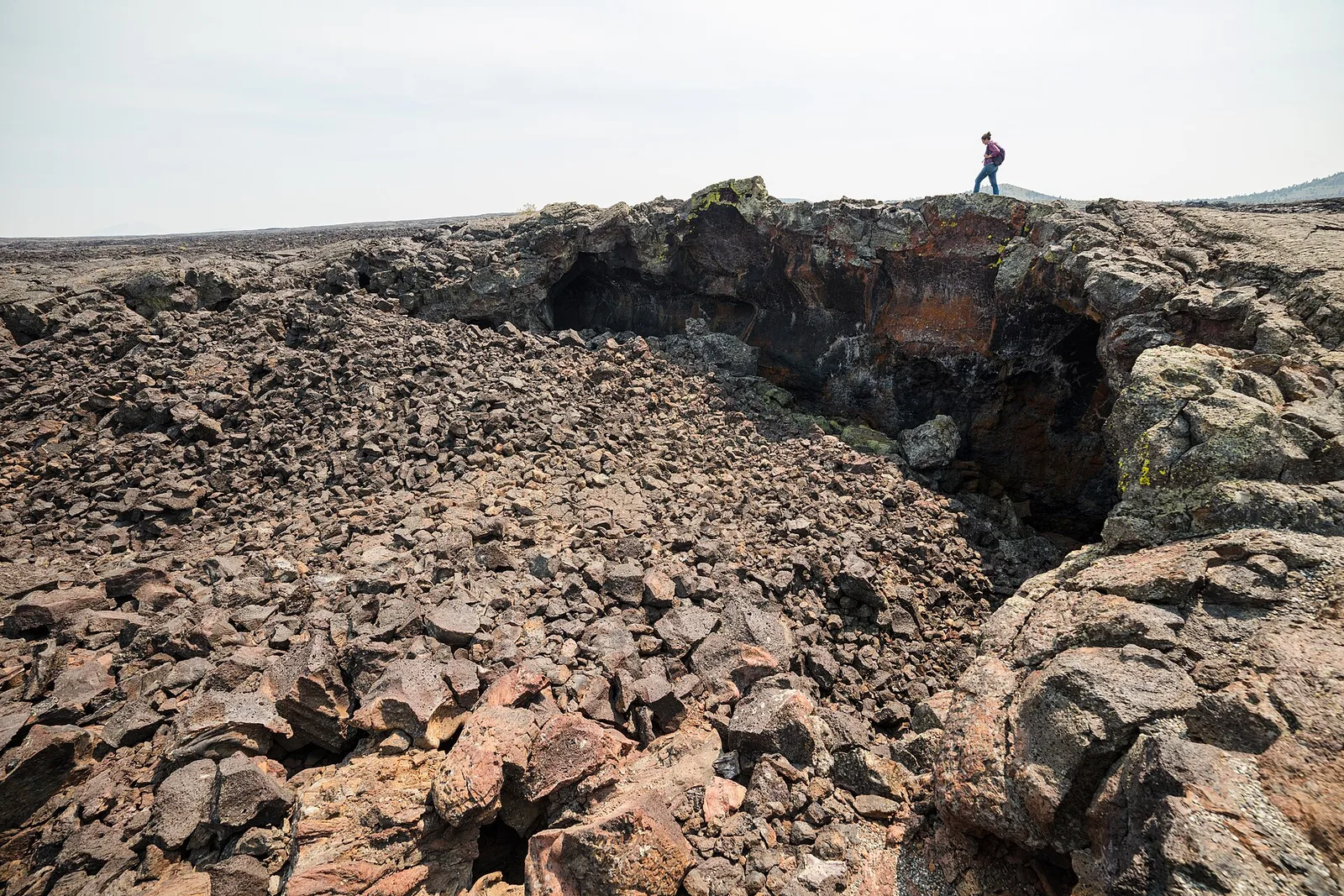
Inside a lava tube at Craters of the Moon, formed 2,000 years ago
At a Glance
Did You Know?
NASA sent Apollo astronauts to Craters of the Moon in 1969 to train for exploring the volcanic terrain of the moon. The black basaltic landscape was one of the best available analogs for what the Apollo crews would encounter.
Some lava tube caves at Craters of the Moon contain permanent ice year-round, even in the hot Idaho summer. The caves act as cold traps, collecting cold winter air that remains trapped through the warmer months.
Despite looking completely barren, Craters of the Moon supports over 2,000 insect species, 148 bird species, and 47 mammal species. The volcanic landscape provides unique ecological niches found nowhere else.
The Great Rift, the volcanic crack that created Craters of the Moon, extends 62 miles across the Snake River Plain and is one of the longest individual rift zones in the continental United States.
Plan Your Visit
Location
Blaine, Butte, and Power Counties, Idaho
Designation
National Monument and Preserve
Best Time to Visit
Late May through October; caves require separate permits in winter
Admission
$20 per vehicle (valid 7 days); America the Beautiful Pass accepted